Photo Gallery
Downrange site display
Former Display location:
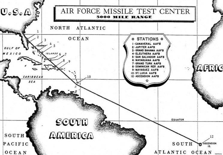
The term “downrange” came into use at the Cape in the 1950s. It refers to the chain of island tracking and telemetry stations originating at Cape Canaveral that is now called simply the Eastern Range. Many of the original tracking stations have disappeared, replaced by more modern methods of controlling and tracking missile flight. This early map defines the downrange chain from those early days.
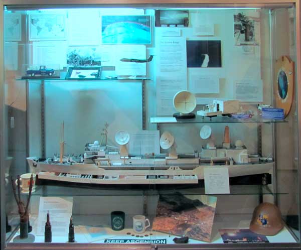
The center room of the museum Exhibit Hall contained several displays dedicated to the Downrange sites, including the islands and tracking ships. Also on display was a large framed map that hung in a Cape administrative office for decades. A display case held island artifacts, photographs and models describing downrange operations.